12/21/2023
Putting a Pin in the Map for GIS Day
Exploring Connections Between Geography, Technology and Energy
Tri-State celebrated Geographic Information Systems (GIS) Day on November 15. This event is part of Geography Awareness Week, which provides an international forum to learn how GIS captures, displays, and analyzes location data in real-world applications. Tri-State uses GIS software provider Esri, which powers the GIS platform used for applications in Lands and Environmental, Energy Policy, Telecom, Metering, Operations, Maintenance, Engineering and other Tri-State departments.
GIS service requests generally come in from internal Tri-State departments. Some of these requests are generated by external needs and are disseminated to the GIS team by departments such as Engineering, Land Rights and Permitting, and Maintenance.
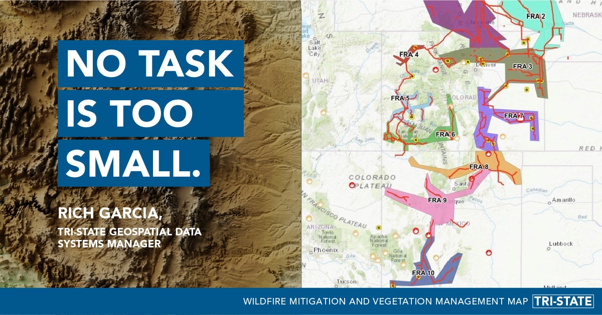
“We handle a large volume of requests each week. No task is too small—if someone needs something visualized on a map or accessible on a mobile device, we make it a priority,” said Rich Garcia, GIS Geospatial Data Systems Manager at Tri-State.

Harnessing GIS for Operational Excellence
GIS aligns with key components of Tri-State’s operational goals such as system reliability, business competitiveness, regulatory management and cooperative innovation to provide reliable power to members. Tri-State staff can put GIS to work in several ways:
-
Tri-State serves 42 distribution system members in Colorado, Nebraska, New Mexico and Wyoming. GIS technology facilitates capital project coordination by combining live streaming data and Tri-State asset information on map applications. The GIS maps contain layers of data such as telecom and transmission structures as well as easement boundaries. Staff in the GIS department ensure this technical information is relevant and accessible to Tri-State staff.
-
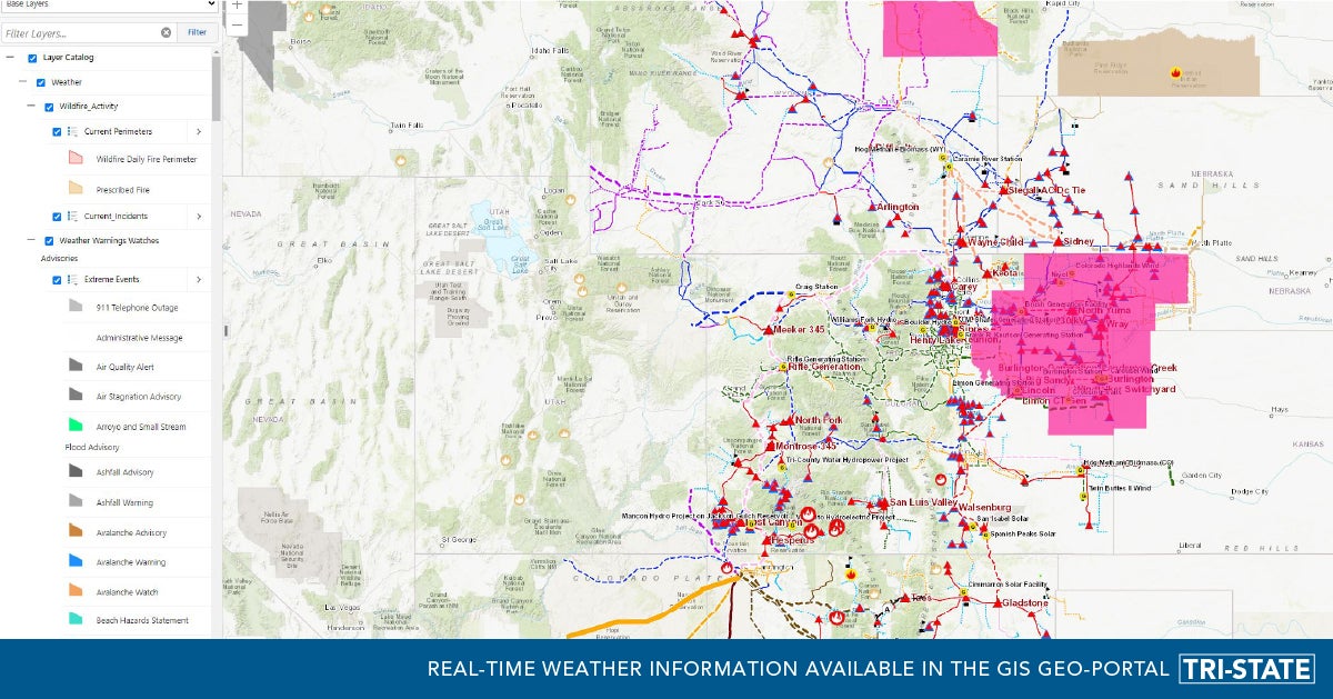
In the event of high winds, blizzards, and wildfires, Tri-State’s Geo-Portal provides staff with map layers such as thermal hotspots, wind, smoke, fire, drought, avalanche watch and red flag warnings for tracking severe weather events. GIS technology helps staff to coordinate emergency response using this data from outside sources such as the National Oceanic and Atmospheric Administration (NOAA).
Wildfires can be a threat to Tri-State’s infrastructure, especially in hot and dry conditions. GIS technology helps staff see fire progression and proximity to critical infrastructure such as substations, lines and poles. Tri-State utilizes data from agencies such as Integrated Reporting of Wildfire Information (IRWIN), National Interagency Fire Center (NIFC), US Forest Service (USFS), and National Aeronautics and Space Administration (NASA). These near real-time applications can show the approximate area of wildfires and aid in responding proactively.

The image above in the GIS Geo-Portal provides real-time weather information for Tri-State staff through different layers, so they can help Tri-State’s members be aware of threats in their area.
-
Tri-State’s robust mobile inspection platform enables the GIS department to provide mapping solutions for transmission maintenance. This platform supports maintenance inspections, new builds and structure replacements.
-
Tri-State’s Planning department performs planning studies as required for North American Electric Reliability Corporation (NERC) compliance to determine the capability of both the existing transmission system as well as planned changes by both Tri-State and other transmission owners which includes the interconnection of large generators. Planning also provides planning studies resulting in capital projects to Tri-State's member systems that require new or modified delivery point facilities due to load growth and reliability. The Planning department provides staff GIS maps for new transmission systems, delivery points, and large generator interconnections as well as member system sub-transmission systems and distributed generation facilities.
-
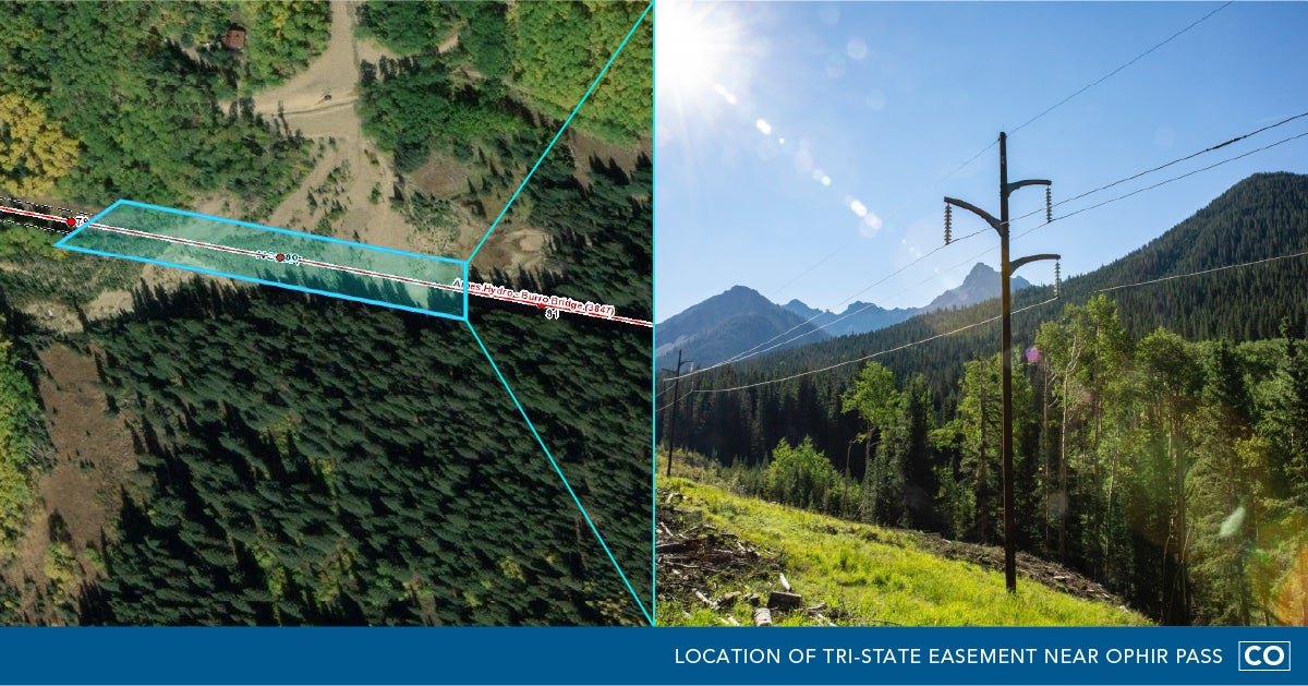
The Land Rights and Permitting staff use an easement layer developed and maintained by GIS to visualize Tri-State's easements along our transmission lines. When they click on an easement, they can access the documents in Tri-State's document management system that show legal description details. If there is work to be done near a transmission line, the GIS easement layer can provide the details where Tri-State has permission to perform that work.
-
Tri-State staff use the high-resolution aerial imagery in a variety of map applications. The images are a compilation of helicopter and satellite images from Google Earth, Esri, NOAA, Microsoft, Maxar, and other sources. Tri-State’s Maintenance department is developing a drone program that may someday be able to augment the availability of high-resolution images in specific areas.
As Tri-State ramps up applications of location-based data, the GIS department is looking into new solutions that will improve data visualization and data collection capabilities.
“GIS isn’t just mapping for utilities; it’s used in virtually every industry. You may be using this technology every day and not even know it. I’m proud that Tri-State has actively supported the use of GIS within the organization—GIS Day is an opportunity for us to showcase that. We’re integrated with a large number of departments across the company, and we hope to do more in the future,” said Garcia.

--
About Tri-State
Tri-State is a power supply cooperative, operating on a not-for-profit basis, serving electric distribution cooperatives and public power district member-owners in four states. Together with our members, we deliver reliable, affordable and responsible power to more than a million electricity consumers across nearly 200,000 square miles of the West. Visit www.tristate.coop.
Blog Posts

What is Beneficial Electrification?

Tips for Switching to LED Lighting

Energy Saving Water Heaters

How to Make Your Home More Energy Efficient in 2021

Advantages of Heat Pumps for Energy Efficiency

Fun Winter Activities for the Whole Family

Gift Ideas for the Electrician

Electrical Safety Tips for the Holidays

