Posted 2/05/2026
Targeting Vegetation Risk with Greater Precision
In the rugged terrain of northern New Mexico, keeping trees and plants away from power lines is a critical part of protecting electric reliability and reducing wildfire risk, especially along the transmission corridors in Carson National Forest. It became clear that without a more precise way to identify and manage incompatible vegetation in this area, efforts to maintain a safe distance between trees and lines would begin to fall behind. The scope of work inspired Tri-State Generation and Transmission Association to optimize how large-scale vegetation projects were planned and executed. It set in motion a new approach that would ultimately reshape how vegetation risk is identified, permitted, and managed across hundreds of miles of transmission infrastructure.

Modernizing Large-Scale Vegetation Management Projects
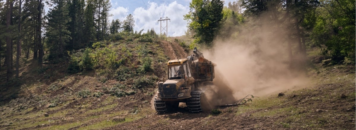
Historically, vegetation management in forested transmission corridors relied on manual field surveys. Crews spent weeks to months patrolling lines, counting trees, and estimating which vegetation posed a risk to infrastructure. This approach grows more complex when applied across long stretches of transmission line, such as those that cross Carson National Forest. On top of that, the difficult mountainous terrain often posed a danger to crews and an obstacle to comprehensive surveys.
Midway through planning a major maintenance effort on the Black Lake–Taos transmission line, the project team recognized that a different solution was needed to provide clarity before boots hit the ground.
A New Vegetation Perspective with an AI-powered Solution
The solution came in the form of Overstory, an AI-powered vegetation intelligence platform designed to help utilities identify and mitigate vegetation-related risk. Vegetation is the single greatest contributor to power outages, and Overstory’s technology enabled Tri-State to see those risks in unprecedented detail. Using high-resolution, satellite-derived data and advanced analytics, the platform identifies and measures individual trees, records their distance from the conductor and right-of-way, and assesses how close they would come to transmission lines if they were to fall. Rather than broad estimates, the data pinpoints exactly which trees pose a hazard and why. The technology can also identify tree health and tree mortality, an indicator of fall potential.
Pilot Project Identifies Removal Estimates in Record Time
For Tri-State, the Black Lake–Taos line became the pilot project for Overstory.
Located in what the US Forest Service describes as a Wildfire Crisis landscape, this stretch of transmission line runs through dense forest, steep terrain, and environmentally sensitive areas with high wildfire risk. It's also a region heavily used by hikers, campers, and other recreators. Additionally, there was significant private property and structures in the project area.
Instead of weeks or months spent counting trees in the field, the project team could now see the full scope of vegetation risk from the outset. The data clearly identified which trees needed to be removed and provided the justification for each decision. When shared with contractors during the bidding process, the information led to far more accurate estimates and significant cost-savings.
“There was so much vegetation in close proximity to those lines that a large‑scale project was necessary to reduce risk in a meaningful way,” said Tri-State's Wildfire Mitigation Program Manager Curtis Hartenstein. “For the first time, we were able to directly connect real‑time vegetation conditions to our overall wildfire risk models and show how treating vegetation lowers that risk,” he continued.
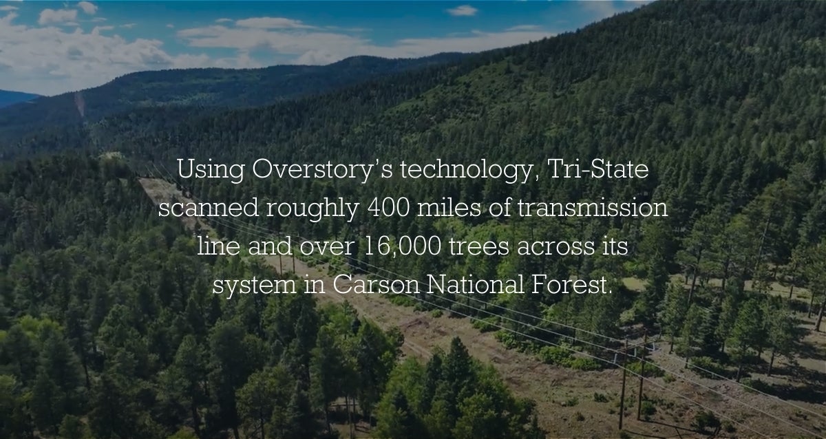
Using Overstory’s technology, Tri-State scanned roughly 400 miles of transmission line and over 16,000 trees across its system. In Carson National Forest, the software identified specific fuel reduction metrics across 13 miles of line and another 20 miles of access roads.
Streamlining Permitting in the National Forest
The new technology also had positive implications for project permitting. Vegetation maintenance on U.S. Forest Service land requires extensive agency coordination, and approvals often involve multiple rounds of documentation and review.
Izzy Beshouri, transmission siting, permitting & environmental planner at Tri-State, played a central role in navigating this process. “Early, transparent permitting and close partnership with the Forest Service and local stakeholders is how you deliver safe, durable results on federal lands,” remarked Beshouri.
Equipped with detailed vegetation intelligence, the team was able to present clear, data-backed justifications for hazard tree removal. The conversation shifted from broad maintenance objectives to concrete wildfire mitigation outcomes, an approach that resonated strongly with federal partners. While permitting still required time and careful coordination, the data brought a level of clarity that streamlined project scoping and approvals, reducing wildfire risk while minimizing environmental disturbance.
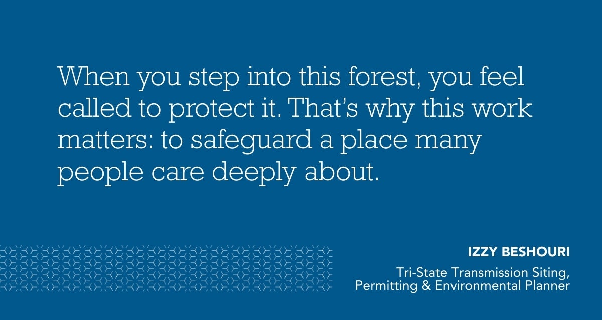
For Beshouri, those efficiencies mattered not just because they streamlined the project, but because they protected a place that is important to millions of people, animals, and ecosystems. “When you step into this forest, you feel called to protect it. That’s why this work matters: to safeguard a place many people care deeply about,” continued Beshouri.
Executing Safely in Challenging Terrain
On the ground, Richard Hejde, Tri-State's senior construction field representative, and his crews translated planning into action. In many areas, traditional ground-based logging was impractical due to terrain and access limitations. Therefore, helicopter logging became a critical component of the project.
This approach introduced its own challenges. The area draws significant recreational traffic and flying logs over active trails and campsites posed serious safety concerns. Precision was essential, and Overstory’s data proved invaluable once again. “Anytime you can take unknowns away from a bidder, you’ll see downward cost pressure. Overstory let us define the scope clearly,” explained Hejde.
Knowing exactly which trees needed to be removed and where they would be transported allowed crews to narrow helicopter flight paths as much as possible. The team could plan when and where the aircraft would fly, communicate temporary closures to the public, and minimize disruption while maintaining safety for workers and recreators alike.
The Importance of Partnerships
This work would not have been possible without strong partnerships and communication, both internally and externally. Early on, Hartenstine and External Funding Manager Jeff King worked to secure grant funding that enabled Tri-State to adopt and deploy the technology.
Key partners included the New Mexico Energy, Minerals and Natural Resources Department (EMNRD), New Mexico State Forestry, Colorado Energy Office, and state foresters in both New Mexico and Colorado.
“New Mexico is proud to support Tri-State in their pursuit of reducing wildfire risk in New Mexico,” said New Mexico State Forester Laura McCarthy. “We are grateful for this public-utility partnership to work collaboratively on the ever-increasing wildfire threat. Together, we can mitigate risk and better safeguard our New Mexico communities and natural resources.”
In Colorado, similar support is helping to expand the program. “We are pleased to support Tri-State Generation and Transmission in their efforts to reduce wildfire risk using satellite data to monitor and maintain transmission infrastructure,” said Will Toor, executive director of the Colorado Energy Office. “Grid monitoring and maintenance is essential to prevent fires while ensuring reliable access to electricity for all Coloradans. This data will help Tri-State and their member cooperative utilities provide reliable service to hundreds of thousands of Coloradans.”
Scaling the Approach
What began as a pilot project has now become a model for systemwide vegetation management. In New Mexico alone, roughly 400 miles of transmission line have been scanned. With new grant funding secured in Colorado, Tri-State plans to assess approximately 2,500 additional miles of line.
The data supports a rotating vegetation management schedule, allowing Tri-State to identify hotspots, prioritize the highest-risk corridors, and allocate resources more effectively. Integrated directly into field crews’ GIS systems, the information ensures that insights gained during planning continue to deliver value long after initial scans are complete.
For Tri-State, the shift from manual surveys to AI-powered vegetation intelligence represents more than a technological upgrade: it marks a fundamental change in how risk is managed across the grid. By pairing advanced data with strong partnerships, careful permitting, and thoughtful execution, Tri-State has created a safer, more efficient, and more transparent approach to vegetation management in some of the West’s most challenging landscapes.
Reducing wildfire risk remains a priority across the region and projects like Black Lake–Taos demonstrate how cooperatives can move beyond reactive maintenance toward proactive, data-driven stewardship that protects infrastructure, public lands, and the communities they serve while still prioritizing affordability.
--
About Tri-State
Tri-State is a power supply cooperative, operating on a not-for-profit basis, serving electric distribution cooperatives and public power district member-owners in four states. Together with our members, we deliver reliable, affordable and responsible power to more than a million electricity consumers across nearly 200,000 square miles of the West. Visit www.tristate.coop.
Blog Posts

Protecting Your Home Year-Round from Wildfires

Summer Backpacking: Solar Power, Energy Efficiency, and the Best States to Visit

Beat the Chill: Effective Insulation Strategies for Winter Comfort
Energy Efficient Heating Options for Rural Communities in the West

Boost Your Business with EV Charging

The Benefits of Having Your Own EV Charger at Home

Geothermal Heat Pumps: Harnessing Earth's Energy for Your Business

Mastering Energy Efficiency with These Home Upgrades